 Narrowsburg
Light Rain Fog/Mist, 43°
Wind: 8.1 mph
 Narrowsburg
DAMASCUS, PA — The Delaware River is the longest undammed river in the eastern United States. The section of river closest to us that we all know and enjoy is called the Upper Delaware River, …
Stay informed about your community and support local independent journalism.
Subscribe to The River Reporter today. click here
This item is available in full to subscribers.
Please log in to continue |


DAMASCUS, PA — The Delaware River is the longest undammed river in the eastern United States. The section of river closest to us that we all know and enjoy is called the Upper Delaware River, which starts in Hancock, NY, and ends in Sparrowbush, NY. This 73-mile stretch of the Delaware River is best known for its excellent water quality, providing superb aquatic habitats and magnificent scenery.
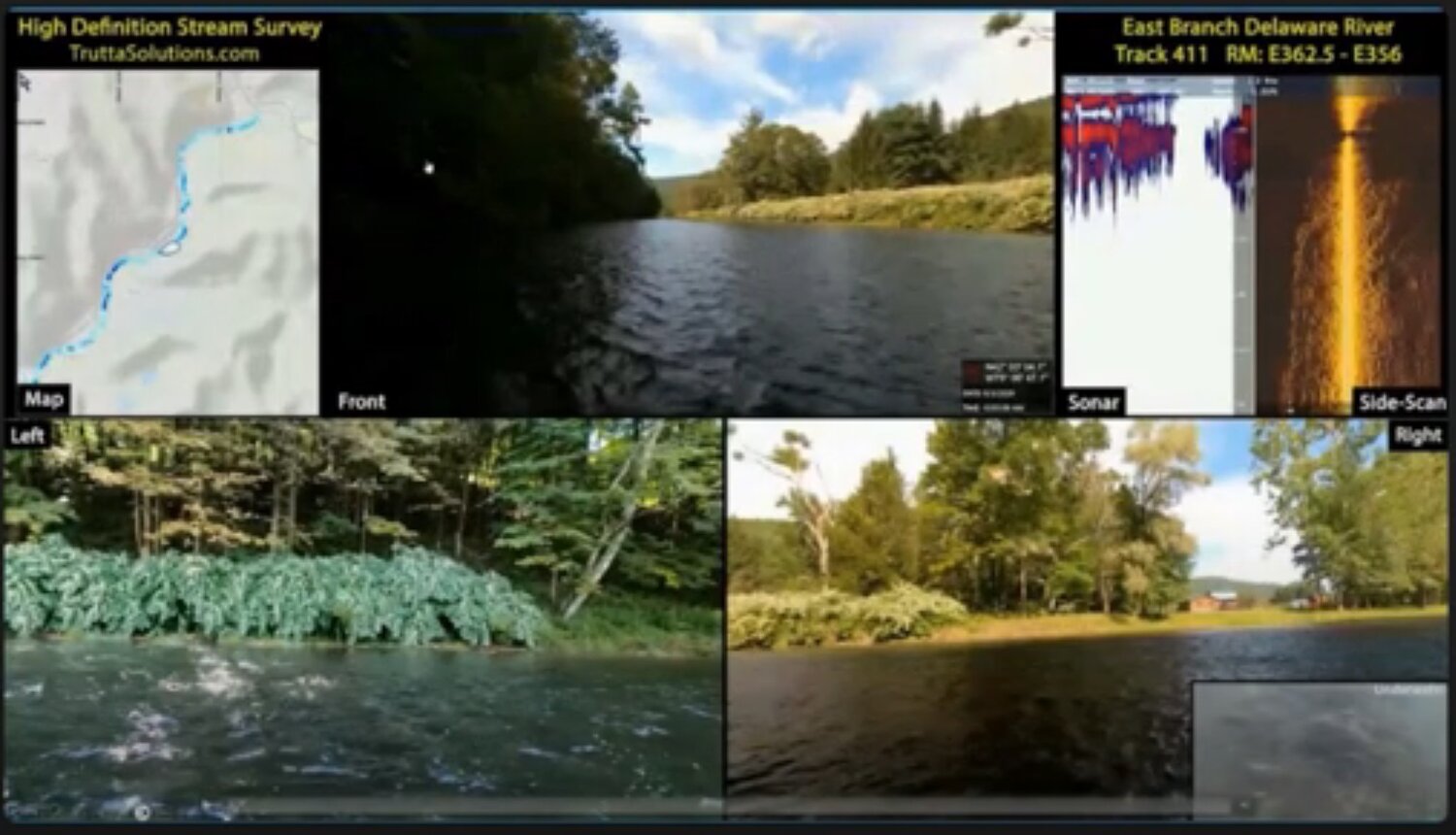
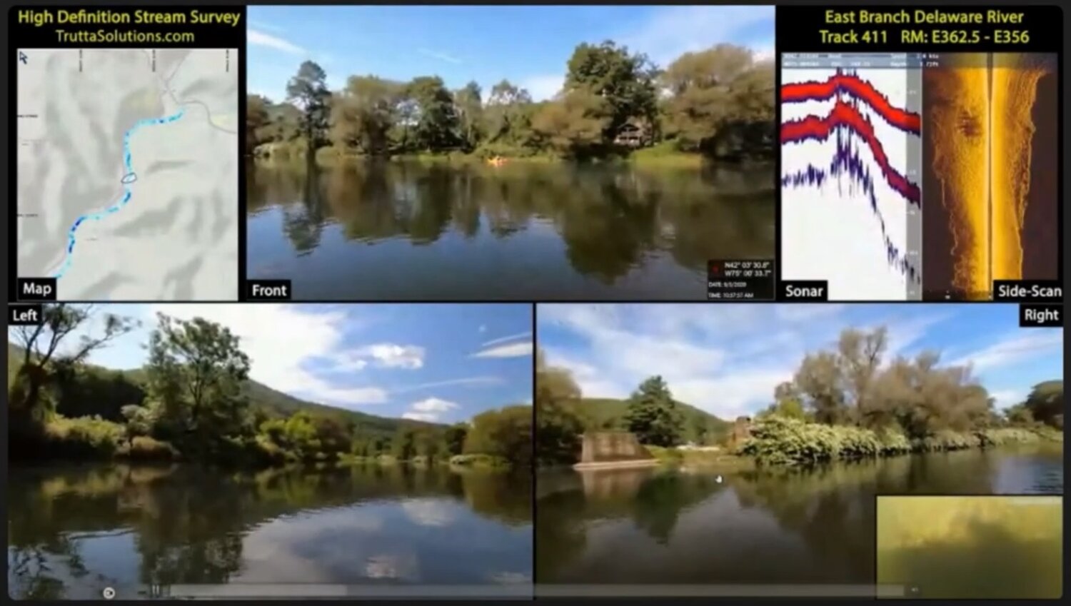
During the early fall of 2020, Trutta Environmental Solutions worked in conjunction with the NYS Department of Environmental Conservation, the PA Fish and Boat Commission, Trout Unlimited and the Friends of the Upper Delaware River to conduct a High Definition Stream Survey (HDSS). According to the project lead, Dr. James Parham, HDSS allows for digital imaging with a continuous collection of streambank, instream, water quality and depth data over long distances. These surveys are also important in that they are able to gather information for a variety of user groups in just a single survey.
This survey was conducted from August 30 through September 6, 2020, and had three main objectives: to identify problems with water quality, water quantity, infrastructure and other issues; pinpoint wild trout habitats; and push for stronger conservation initiatives.
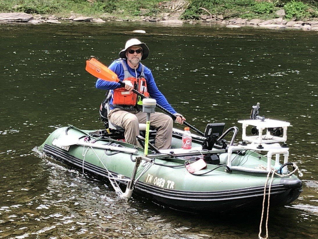
The data for all 73 miles of the Upper Delaware River was collected using mostly kayaks and boats, but occasionally backpack systems were used when the river was too shallow to allow boats through. Each boat was equipped with a myriad of sensors and cameras to record the left and right streambanks, canopy covers, riparian zones and infrastructure (bridges, dams, etc.). The boats also contained video and sonar technology to measure depth, elevation, substrate type and vegetation. In addition, water quality samplers were used to measure data such as dissolved oxygen levels, pH and temperature. The raw data collected from these samplers will identify problems related to water quantity and quality.
Additionally, some of the data must be combined to achieve a specific outcome. For example, depth, velocity, substrate and cover data are all used to determine aquatic habitat suitability for different species, specifically wild trout. This data is fed into an algorithm that outputs habitat types. The algorithm is then able to determine which sections of the river are suitable for certain species and their specific life stages. Once these habitats are identified, conservation initiatives can be taken to protect these vulnerable habitats, especially their spawning areas.
This project is extremely significant in that it is a baseline, meaning that it is a starting point. Therefore, if more HDSSs are conducted for this section of the river in the future, this original survey can be compared to new ones and be used to document changes over time.
In addition, the entire survey was mapped using GPS tracking. The information obtained can easily be inserted into the geographic information system so that it can be shared with the scientific community.
The aim of this project is to keep the Upper Delaware River a thriving ecosystem that will sustain us all.


Comments
No comments on this item Please log in to comment by clicking here