 Narrowsburg
Light Rain Fog/Mist, 43°
Wind: 8.1 mph
 Narrowsburg
REGION — By the time most readers have this copy of the newspaper in hand, a second snowstorm will likely have made its way through the region dropping an estimated seven to 16 inches of snow …
Stay informed about your community and support local independent journalism.
Subscribe to The River Reporter today. click here
This item is available in full to subscribers.
Please log in to continue |

The sign marking the Hamlet of Barryville was a victim of the storm.
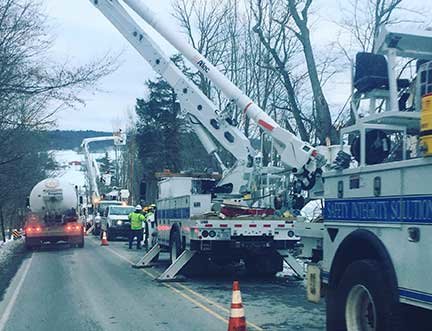


REGION — By the time most readers have this copy of the newspaper in hand, a second snowstorm will likely have made its way through the region dropping an estimated seven to 16 inches of snow on top of the snow already on the ground. The National Weather Service reported on March 6, “another fairly high-impact storm” for March 7. Heavier snow should move into the Poconos during the mid- to late-morning hours and back northwest toward the I-81 corridor by early in the afternoon before pulling eastward later in the afternoon and evening. “Options on the table include the furthest east [path], which would confine the heaviest totals to Pike and Sullivan counties.” It was projected to bring eight inches or more to the region. The winds were not expected to be nearly as fierce this time around as they were for the March 2 storm.


Comments
No comments on this item Please log in to comment by clicking here